Return to: USA primary source maps, illustrations | Inquiry Unlimited | USA timelines | literacy resources

 Teaching Children Social Studies with Maps
This lesson's visual focus: Map interpretation of Boston.
|
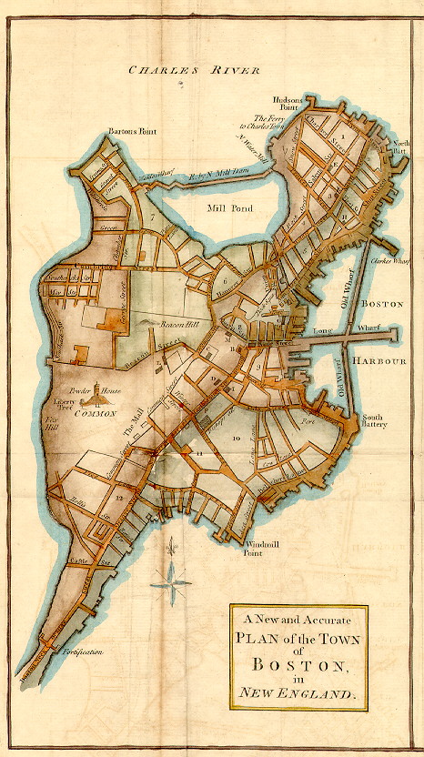
A New and Accurate Plan of the Town of Boston,
in New England *.
What can we learn about life in 1770 Boston from analyzing this map?
As of October 16, 2006, you are visitor  to pursue "Teaching Children Social Studies with Maps."
Literature Circle roles | USA A - M resources | Revolutionary Period | artifact box
Last modified: October 16, 2006.
* This map is located here for classroom practitioner use to broaden student skills in the classroom. It is not the property of Inquiry Unlimited.